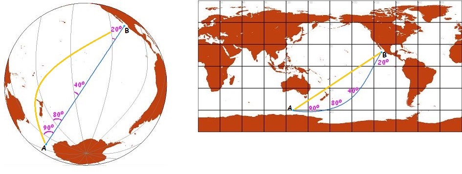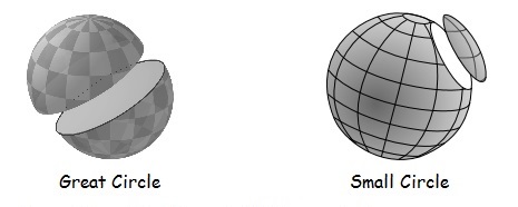
| One concept that we must be clear on is the nature of lines drawn on the surface of the Earth. All straight lines drawn on the surface of a sphere look like circles when viewed from the right location (the point equidistant from all points on that line). There are two types circle on a sphere: Great Circles, which slice the sphere through its centre (the centre of the sphere and circle are the same) and Small Circles, which do not. Great circles are the equivalent of a straight line drawn on a flat surface in that the shortest distance between two points on the surface of a sphere is a segment of a great circle. Great circles also look straight when viewed from directly above any point on the line (see the equator and prime meridian lines in the blue and yellow diagrams below). | |
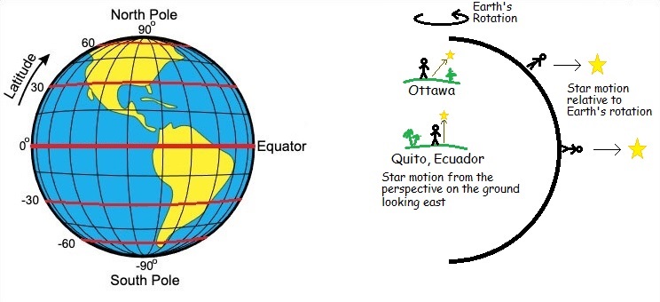 |
Latitude This is an angular measure that indicates the angle between a location and the equator. You know you are on the equator by the fact that when looking east, celestial objects rise up on a path perpendicular to the horizon. One's latitude also is indicated by the angle between the north star (Polaris) and the horizon. If Polaris is directly overhead, you are at the north pole (90 degrees latitude). If it is at the horizon, then you are on the equator. There are visible stars that are almost directly over the south pole that can be used to determine latitude south of the equator, but they are not part of easily recognisable constellations. The precise nature of this measurement is slightly complicated by the fact that the shape of the Earth is an ellipsoid rather than a sphere, but the difference is not usually important for the precision needed by geologists. All Latitude lines are small circles (except the equator) and are parallel to the equator. Thus, they are often called parallels. Check out this minutephysics video on the subject of Earth's poles. The poles that we are talking about in this context are the geographic poles. |
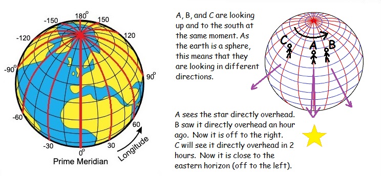 |
Longitude Longitude lines (called meridians) are great circles that pass through both the north and south geographic poles and intersect the equator and all other latitude lines at an angle of 90 degrees. Thus, it can be seen that any triangle drawn on the surface of the earth (or any sphere) must have interior angles that add up to more than 180 degrees. The fact that this is true for triangles on the earth is one of many indications that the earth is not a flat structure. Your longitude is the angle between the meridian that you are on and the meridian used as a reference datum. This reference longitude is called the prime meridian. The difficulty with defining a prime meridian is that there is no objective uniqueness to any partiular meridian the way that the equator is unique among all parallels. So, we had to pick one (or many, there was much disagreement). We eventually settled on the meridian going through Greenwich, England. The trickier issue is how to measure what meridian a particular location is on. This can be done with reference to the stars and a good clock. The earth rotates through 360 degrees every 24 hours (23 hours, 56 minutes, 6 seconds). This is a rate of roughly 15 degrees per hour. Set up a telescope at some location on the prime meridian on a perfectly vertical tripod and point it due south or north. We can make sure of this alignment by reference to the north star. When it is midnight in Greenwich, England, check to see which star is perfectly lined up with the centre of the telescope view. Anyone else can repeat this process anywhere else on the earth. If they see the same star centred in their telescope at midnight Greenwich time, then they also are on the prime meridian. If that star lines up with their telescope at 11 PM Greenwich time, they are on the meridian 15 degrees east of the prime meridian. If that star lines up at 2 AM Greenich time, then they are on the meridian 30 degrees west of prime. |
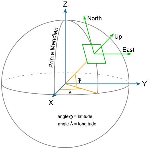 |
In summary, rather than use three distance co-ordinates x, y, z to describe a location on the earth we use two angles: longitude (an angle along the equator between your meridian and the prime meridian) and latitude (an angle along your meridian from the equator) as well as a distance along a line from your location to the centre of the earth. The diagram to the left makes some interesting points about direction which are not of much concern when one is worried about location on the earth, but become important when thinking about observations of objects in space. Examples: Up is a direction opposite of the direction to the centre of the earth. We don't often look in this direction. Usually we look at the sky in some compass direction (north, south, southeast, etc.) and up 20 to 40 degrees from the horizon. The only time we are likely to look straight up to the "top of the sky" (also called the Zenith - the opposite of which is the Nadir) is when we are lying on our back on the ground. If you are on the equator, then your view to the north is the same direction as the Zenith view for someone at the north pole. Your view of the Zenith is the same direction as the eastward view of someone 90 degrees of longitude to the west of you. When you are at the north pole every direction that you look is south. |
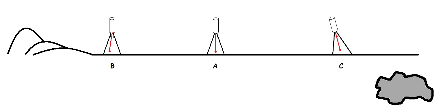
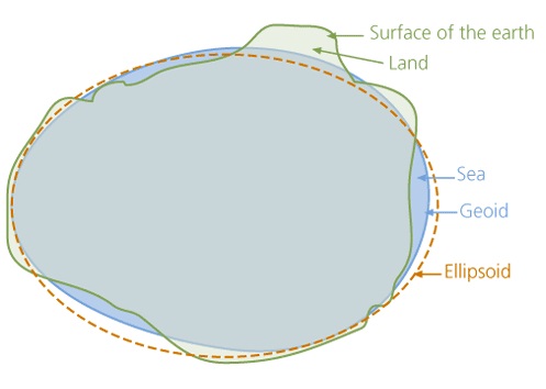
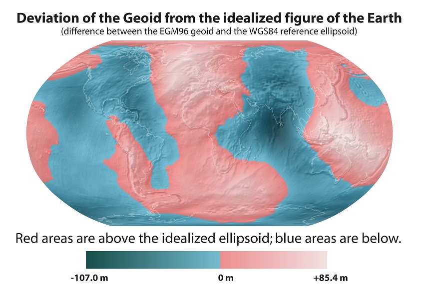
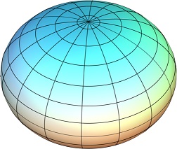
| 2) Reference Ellipsoids. It is difficult to draw nice straight lines along a fairly lumpy surface such as the Earth's. Thus, surveyors derive equations for nice, smooth mathematical ellipsoids that approximate the overall surface of the Earth. These mathematical models are called reference ellipsoids. They represent the earth as a smooth shape without features like mountains and valleys. The location of latitude and longitude lines are referenced to these ellipsoids. Historically, each country adopted its own ellipsoid that best approximates the land surface for that country. In the modern age, the need for GPS to give sensible readings meant that every country uses the same ellipsoid, the one used by the US government (since they control the GPS satellites). This ellipsoid is called WGS84. This ellipsoid not only approximates the overall shape of the Earth fairly well, but also has its centre at the same point as the centre of mass of the Earth. This is a necessity for any ellipsoid used to control a system of orbiting satellites. This video by Tom Scott shows some of the issues involved with this ellipsoid. The trick with an ellipsoid is that vertical - perpendicular to the ground surface - is not always where a plumb bob would point (centre of the earth). |
 |